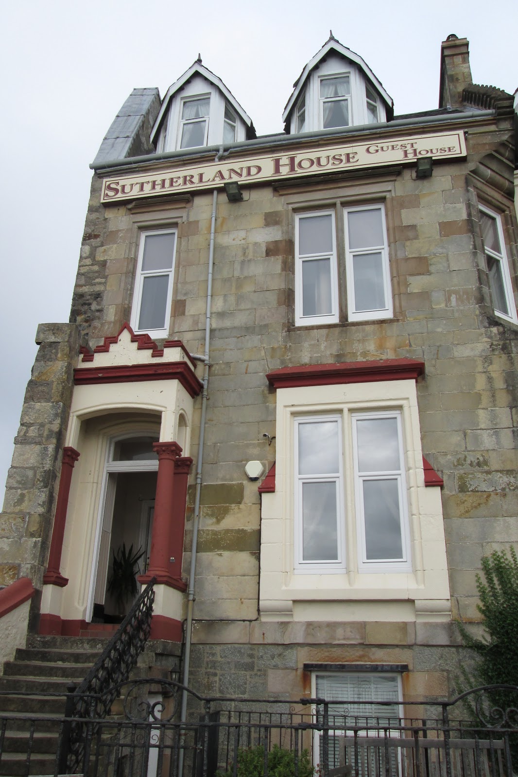
Back in August we treated ourselves to a little trip to Oban in Argyll without the motorhome. Yes we splashed out and stayed in a small guest-house called 'Sutherland House' at the north end of Oban Esplanade:
 |
| Sutherland House where we stayed |
It was a lovely little guest-house and the guy who run it was very welcoming and helpful. We were given a lovely room on the top floor..... no lift unfortunately..... but we did have a fantastic view out the window:
 |
| Our Top Floor Room |
 |
| View of Oban Bay from Our Room |
Once we got unpacked we decided to go for a walk along the esplanade towards the town centre so we could grab a cup of coffee and check the place out. At the southern end of the town is the railway station and also the main ferry terminal where you can get to lots of exciting places like Mull, Barra and Colonsay (we didn't go to any of these places though):
 |
| View From Ferry Terminal Towards North Pier |
 |
| Looking back towards Oban (McCaig's Tower on skyline) |
 |
| Moira on Oban Harbour Wall |
It was starting to get a bit late now so we headed back towards the guest-house so we could freshen up before we went out for a meal. I did take a couple of photos on the way back though:
 |
| Oban Bay from Town Centre |
 |
| Looking North Towards the Churches |
That evening we had a lovely meal in a posh fish and chip shop, followed by a stroll along the esplanade to aid digestion and enjoy the pleasant evening sunshine:
 |
| Oban Harbour Front in the Evening |
 |
| Oban Bay (with incoming Black Guillemot) |
Yes we did see a Black Guillemot, it was nesting in a hole on the harbour wall and made several feeding trips whilst we watched it (no I didn't have my camcorder with me!). But I did capture the lovely sunset with my phone camera:
 |
| Sunset over Oban Bay |
I thought I would celebrate a beautiful evening with a pint and an Oban whisky before returning to the guest-house; conveniently Markie Dan's pub was next door:
 |
| A hauf an a hauf |
........and so to bed.
The next morning was not as stunning as the previous evening; in fact it could simply be described as dreich, as viewed from our guest-house window:
 |
| Ferry steams in to Oban harbour on a dreich morning |
Not to be put off by the wet weather we chose to jump in the car and drive to the Oban Sea Life Centre (which is at least 15 to 20 minutes drive north of Oban).
Last time I visited this Sea Life Centre was back in the late 1980's and I'm afraid some parts of it haven't changed much. It did have a nice cafe (which wasn't there in the 80's) and it also was still doing sterling conservation and animal rescue work............ so worth visiting and supporting it.
Here are some photos I took with apologies for the poor quality of my images:
 |
| Little Seahorse |
 |
| Larger Seahorse entwined with a rope |
After the Sea Life Centre we headed north over the Ballachulish Bridge and on to Fort William where we had some lunch. The weather hadn't improved much and the town centre of Fort William wasn't the most picturesque place I have ever been to, so we decided to take a leisurely drive back south towards Oban.
We stopped at the Castle Stalker View Cafe near Appin on the way back for a coffee break and it did indeed have a view of Castle Stalker:
 |
| View towards Castle Stalker |
This 14th century castle featured in films such as Highlander Endgame and more famously as 'Castle of Aaarrrgggghhhh' in Monty Python's Holy Grail. It started raining again so I didn't walk nearer to get a better picture, I did however capture some geese flying overhead:
 |
| Geese Flying Overhead |
The weather didn't improve much for the rest of the day. We managed to get out for a meal in the evening without getting soaked, apart from that we had a quiet night in.
The next morning couldn't have been more of a contrast as we awoke to lovely sunny day:
 |
| Sunny Day at Oban Bay |
Compare the following view from our window of the ferry arriving with yesterday's photo and you will notice the difference:
 |
| Ferry steams into Oban Harbour on a sunny morning |
What a contrast!
As it was such a nice morning we decided drive up to McCaig's Tower to enjoy the view (far too steep for us lazy, auld yins to walk). Perch on the hill above Oban McCaig's Tower (aka McCaig's Folly) is certainly an impressive structure and does have commanding views:
 |
| Inside McCaig's Tower |
 |
| View from McCaig's Tower |
 |
| Moira at McCaig's Tower |
 |
| Eddie at McCaig's Tower |
This 200m circular tower was constructed in granite sourced from the nearby Bonawe quarry by wealthy banker John Stuart McCaig as a monument to his family. It was based on the Colosseum in Rome and was built between 1897 and 1902, providing sorely needed work for local people over the winter months.
I think the video below provides a good panoramic view of the incoming squall which forced us back to the comfort of our car:
Lovely rainbow though!
After visiting McCaig's Tower we drove a few miles along the A85 to Dunbeg, where we stopped for a spot of brunch at the cafe in Poppies Garden Centre. They do great food and the view from the cafe is not to shabby either:
 |
| View from Poppies Cafe |
In fact the views from the car park at Poppies are quite picturesque as well:
 |
| Pond at Poppies Car Park |
 |
| Dunstaffnage Marina |
 |
| View across Ardnucknish Bay |
A little further along the A85 takes you to Connel Bridge, which you cross if you are heading North to Fort William. We however were heading East towards Loch Awe, but we did stop briefly to capture the phenomenon that is the Falls of Lora.
These 'Falls' are the result of a geological fault which has led to a rocky shelf being created under the water at a narrow point where Loch Etive discharges in to the Firth of Lorn. At low tide the water level in the loch is higher than that in the firth effectively creating white water rapids.
Connel Bridge has obviously been constructed at this narrow neck as it is the shortest crossing point.
 |
| Connel Bridge and The Falls of Lora |
I think this video will probably represent the power of the 'Falls' better than a photograph (although it can be a lot more turbulent during spring tides):
The Falls of Lora are apparently a favoured spot for thrill-seeking kayakers to ride the white water!.............. not my idea of fun.
We headed East along the side of Loch Etive, passing by Taynuilt and through the Pass of Brander (where Robert the Bruce was reputed to have won a famous battle). Here the River Awe, The A85 road and the Glasgow to Oban railway line all weave a similar path through the narrow pass:
 |
| The Pass of Brander |
The other side of the pass lies Loch Awe, a large L-shaped body of water that claims to be Scotland's longest inland loch (if you measure round the 'L' that is). Either way it is a large loch, surrounded by hills and contains several islands, some with buildings on them:
 |
| Across Loch Awe from A85 |
 |
| Sunshine on Loch Awe |
 |
| Kilchurn Castle on the Shores of Loch Awe |
 |
| The Mountains Surrounding Loch Awe |
Loch Awe and the surrounding area is green, lush and simply stunning............. the reason being it rains a lot.......... and where there is lots of rain water there are hydro-electric power stations. We had organised a visit to one such hydro-electric power station, namely Cruachan Pumped Storage Scheme, which sits on the edge of Loch Awe at the foot of Ben Cruachan.
Cruachan power station lies 3/4 of a mile underground, built inside a huge James Bond-like cavern within Ben Cruachan (commonly referred to as the Hollow Mountain). Unfortunately you are not allowed to take photographs of the underground power station, however I did happen to work there some thirty years ago so can share some old 1980's photos with you:
 |
| View of Units 1 & 2 from Overhead Crane |
 |
| View of Pony Motors on Upper Level |
The power station has four Generator Units, each comprising a water inlet valve (the big blue thing in the top picture), a water turbine, a high voltage generator and a pony motor. Each unit can generate a 110 Megawatts of power and work a bit like this:
- Water from the upper reservoir (on the top of the mountain) flow down a pipe to the inlet valve
- The inlet valve is opened and turns the impeller on the water turbine
- The impeller is connected by a shaft to the rotor of the generator, which also turns
- The rotor generates electricity (at 20,000 volts) in the stator of the generator, which then goes through a transformer which converts it to 11,000 volts which then connects to the National Grid
What about the pony motor I hear you ask?
Well because Cruachan is a pumped storage scheme, it generates electricity when it is needed at times of peak demand (e.g. kettle on when Corrie finishes) and when demand is low (such as the early hours of the morning) it pumps the water back up to the upper reservoir using the Pony Motor ready for the next peak demand.
Back to 1980's when I was in charge of a team of engineers, fitters, electricians and winders refurbishing Unit 1 and Unit 2 in Cruachan. Here is a black and white photo of some of my team back then:
 |
| The Winding Team at Cruachan (circa 1986) |
No I am not in the photo but it represents an international workforce of a Scottish Engineer, a German Engineer and six Brummie Winders. For those who followed the description of how a generator works, they are standing above the stator, with the 170 tonne rotor removed of course.
I also gained vehicular access to the upper reservoir at the top of Ben Cruachan back in 1986.............. not something the public are allowed to do............ you can walk up the mountain if you wish (it's only about 2,500 feet above Loch Awe).
 |
| The road to the upper dam (Loch Awe in background) |
 |
| Ben Cruachan Dam (circa 1986) |
 |
| Ben Cruachan Dam and Reservoir (circa 1986) |
 |
| View down The Pass of Brander from Ben Cruachan |
Enough of this nostalgia, back to 2018.
At the Cruachan visitor centre they have a lovely little cafe with nice cakes and things.......... anyway in this cafe they also have a sign saying that Pine Martens occasionally visit the bird table outside the cafe window. Having tried to spot Pine Martens for many years and never ever having had a glimpse of one, I thought........ "what chance of seeing them here?"
Oh boy I was wrong....... so wrong! We were approaching the tables outside the cafe (where the bird table is) when I saw something moving in the nearby hedge:
It disappeared as quickly as it arrived, but we got absolutely brilliant views, I could hardly believe our luck. So I thought why not sit at the table near the bird feeder in case it comes back......... and ten minutes later........ they did:
What a fantastic few days we had: gorgeous scenery, good food and drink; great views of wildlife; historic sites; engineering marvels; etc.......... highly recommend you visit this area.......... never mind the weather!
Take care
Teddyedward