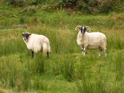
To those of you who are Munro-baggers the ascent of Minch Moor would be a stroll in the park but for a mere mortal such as myself it was a fair hike up a hill. Standing at 567 metres (that's 1860 feet in old money) the summit of Minch Moor is not even a Corbett (hills between 2,500 and 3,000ft) never mind a Munro (hills above 3,000 feet).
Anyway I parked up at Traquair village hall and made my way along the track that forms part of the Southern Upland Way. Being a bit cold with the threat of rain I was suitably dressed in my fleece and anorak, however after fifteen minutes of walking uphill I had to stop and shed some clothes as I was so hot.
When I stopped I had a look back down the valley towards Innerleithen and even at this height the view was pleasant (although I did get strange looks from the cows in the field):
 |
| View of Innerleithen |
Any sighting of them was fleeting and there was no way of getting a photo of them, especially since I only had a small compact camera with me. These compacts are great for fitting in your pocket but when you are trying to photograph wildlife the time taken from pressing the button to taking the picture is just too slow and what ever was there has gone.
A little further along the track I came across a rustic wooden bothy where I stopped to have a bite to eat (hungry work this mountaineering):
 |
| Love this Bothy |
 |
| Tweed Valley from Bothy |
The aforementioned 'Point of Resolution' sculpture and the heather circles (as viewed through the eye of the sculpture) are shown below:
 |
| Resolution Point Sculpture |
.JPG) |
| Through the Round Window |
In fact I saw no-one apart from a couple of mental mountain bikers trying to kill themselves (and anybody in their way) as they hurtled down the hill-side.
Whilst traversing the moor I stopped to observe the age-old custom of appeasing the fairies at Cheese Well..........no I have not lost my marbles!! The story goes that you have to leave a donation of food (commonly cheese) at this freshwater spring to appease the wee folk and they will grant you a trouble-free journey.
As I had no cheese with me I left a corner of my Alpen cereal bar, which I thought was relevant as I was heading to the summit.
Near the end of the moorland stretch I reached a fork in the path where the Southern Upland Way carries onwards to Portpatrick (some hundred miles away on the west coast) but I was taking the right hand fork and heading to the summit of Minch Moor (a few hundred metres away). You can see I had to think hard which route to choose:
 |
| Portpatrick or Minch Moor?? |
 |
| The Cairn at the Summit of Minch Moor |
 |
| View from Minch Moor with Eildon Hills in Background |
On my descent I chose a slightly different route and followed the track alongside the Camp Shiel Burn (which was a bit soggy under-foot) which led surprisingly to Camp Shiel. Here I found a beautiful cottage which was only accessible by a rough farm track, but what really fascinated me was some of the old out-buildings which surrounded this cottage.
There were stone buildings and wooden sheds with corrugated tin roofs:
 |
| Camp Shiel Out-buildings |
 |
| Camp Shiels Summer-House? |
I beat a hasty retreat and walked along the farm track which followed the Fingland Burn. This was a great little burn, fast flowing, gravel-based, the sort you would expect to see a Dipper on (my favourite bird) but I didn't see any.
I did see a tree growing up through the burn, which was strange, maybe the burn had changed course over the years and the tree was there first!!
 |
| Tree in Burn |
 |
| You shouldn't be here!! |
I passed by another cottage which wasn't as nice as the Camp Shiels one and definitely looked like it needed a bit of TLC:
 |
| Damhead Cottage |
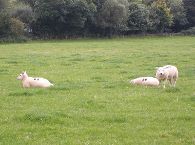
Just before I reached Traquair and the end of my journey I noticed some other sheep in a field which didn't seem to have the same aggressive attitude as the previous ones. In fact they were being very helpful by suggesting some lottery numbers for me to use:
 |
| Sheep Bingo |
Take Care
Teddy Edward

Hello Mr. Edwards, I found your blog and photographs while looking for information on Camp Shiel in the Traquair/Innerleithen area. I enjoyed your stories and photos...beautiful! My grandmother lived at Camp Shiel from 1900-1919 or so; I visited there in 1978. You mentioned in your blog that you had seen the cottage there but did not post a photo. Do you have any photographs of the cottage at Camp Shiel you would be willing to share? Thank you, Mary Morris Hutnik
ReplyDeleteMary,
ReplyDeleteGlad you enjoyed my blog, unfortunately I don't have any photograph of the cottage at Camp Sheil. It was occupied when I passed it so I did not want to offend anybody by taking a photograph.